App “World Transit Maps” lands in the Americas! Free railway maps of United States will release

App "World Transit Maps" lands in the Americas! Free railway maps of United States will release

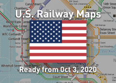
Our app “World Transit Maps”, which is popular all over the world, is adding “United States” to the service territories. It is the first in the Americas. The railway maps of 14 areas covering the entire United States will be distributed free of charge from Saturday, October 3, 2020. It includes all rail transports. For example, the long-distance and intercity railroads “Amtrak” that connect major cities in the US, commuter railways, subways, metros, and light rails that run in metropolitan areas such as New York and Los Angeles. Since the location of the airport is also displayed, you can easily understand the positional relationship with the downtown. That would help…

Read More

Pre-operation of “TOKYO BRT” connecting Tokyo downtown and the coastal areas started

Pre-operation of "TOKYO BRT" connecting Tokyo downtown and the coastal areas started

The bus rapid transit system “TOKYO BRT” was opened on October 1, 2020 to meet the traffic demand in the Tokyo coastal areas where the population continues to grow. Keisei Bus is in charge of the operation. For the time being, it is positioned as a pre-operation (primary), and the one shuttle launched from Toranomon Hills (connecting to the station of the Tokyo Metro Hibiya Line) to Harumi BRT Terminal. The new stops are as follows. Toranomon Hills (虎ノ門ヒルズ, B11) Shimbashi (新橋, B01) Kachidoki BRT (勝どきBRT, B02) Harumi BRT Terminal (晴海BRTターミナル, B22) A total of 9 vehicles Tokyo BRT exclusive featuring pastel rainbow colors have been procured. One of them…

Read More